Vung Tau – Hanoi – 26 Days
Route Summary
Duration: 27 days - 5,900 kms
These are my recommended series of day routes to see and experience the best of the entire country above Ho Chi Minh City. The Mekong below offers very little for the rider but to tick the box add at least a week down there. From both the riding, culture and landscape perspectives this is as good as it can be done.
Each year i have done variations of this taking up to 50 days each time. When you’ve explored all the options its easy to pick the best.
Notes
Add days in Nha Trang, Quy Nhon, Hoi An, Danang, Hue, Phong, Tam Coc, Sapa and Halong Bay. All good options to extend your experience. With some days start and finish this becomes a very memorable way to spend six weeks of your life.
Adding to the bucket list is easy. Starting to empty it takes a lot of planning and commitment. We’ve covered the planning. The rest is up to you.
Click for Route details:
Vung Tau - Bao Loc
Distance: 300 kms
Day one out of Vung Tau is just so much nicer than out of Ho Chi Minh City. We start off along the coast rather than having to battle the city traffic. Some weekend tourist traffic along this stretch but very quiet weekdays.
(A & B) gets you the best way out then,
(C & D) take you for a look through an interesting fishing village.

The road leaves the absolute coast then a little and some heavy vehicles to be aware of until you get to
(E) on the map which is a great coffee stop on the water. Fully renovated now so this quaint little bar no longer.


Go easy speed wise into and out of Lagi. The traffic police in this area are rather dedicated.

Once you cross the A1 its game on though to your night destination really.
Note: In the first 5km after you cross the expressway there is often cattle on the road.

Good consistent hot mix. Fast open sweepers early then tightens up in the mountains. If you’re scratching the pegs here you won’t anywhere. One of my favourites in the South.

(F) missing this detour will cut your day by 15 km but a great lunch and swim spot.
(G) The first lake is worth the short detour but the road into the dam wall is sometimes closed of late.

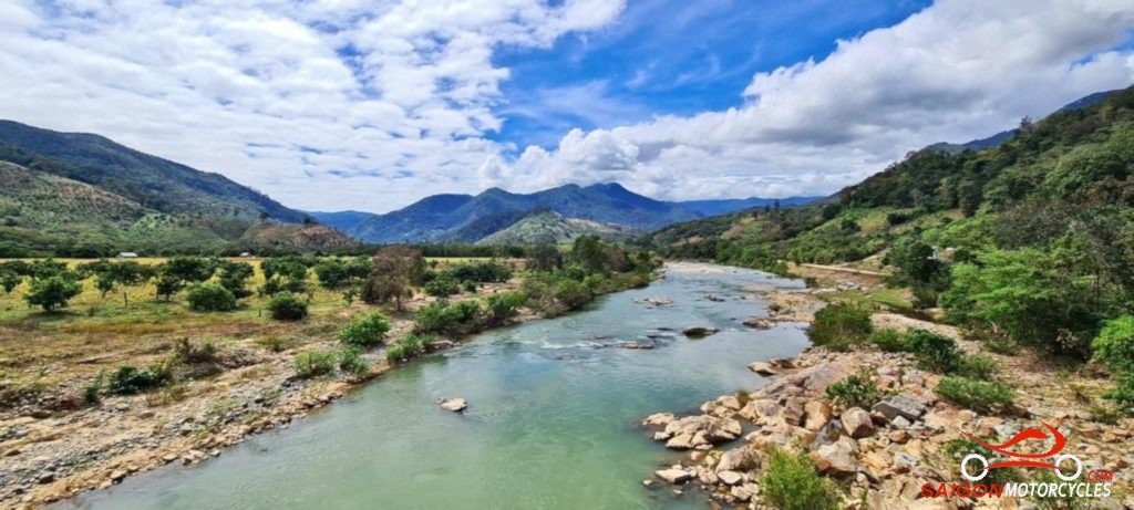
(H) on the map is a detour 10 km each way and really worth doing if you have the time. Some great photo stops around a very picturesque lake system.

Bao Loc, home to the Ma Indigenous people is the commercial hub of Lam Dong province. A city of around 200,000 people with elevation of 850 Metres. Like Dalat, it can get cold at night and my experience has been that if its going to rain it will here.
Log in below to view full route maps, accommodation and food information.
These are supplied to all our touring bike customers.
(Excluded from the above itinerary)
Bao Loc - Ta Dung - Dalat
Distance: 250 kms
As you will find evident with most of my recommended routes, the best way is far from the shortest way. Today’s ride is a great example of that. We literally go backwards to go forwards but so worth it.
(A) takes you around the dam wall as you can no longer ride over that. Good photo spot when you get to the wall. Especially if they are letting some water go.


(B) is your lunch stop. The food’s good and the restaurant views up with the best.
(C) a café I often stop at but added primarily as a way point otherwise Google will take you places you don’t want to be.
(D) is worth a stop. Climb up into the statue for great countryside views if you’re feeling fit. The Buddhist prayer area inside the statue at the base is worth checking out and from the base the best view of the waterfall also.

You’ll find plenty of great photo stops during the afternoon ride. Really a great day in the South particularly given how terrible the busier options are.

Lots of accommodation options in Dalat but even so can be very busy in holiday times so it’s wise to book ahead.
(F) a favourite I use a lot. Quite unique particularly if you’re with a lady and a short walk to the night market and many of the recommended food options listed.
Log in below to view full route maps, accommodation and food information.
These are supplied to all our touring bike customers.
(Excluded from the above itinerary)
Da Lat - Sorrento Beach Club
Distance: 215 kms
This is one of my favourite ride days in the South. A mix of great mountain and valley riding with some incredibly beautiful coastline thrown in.
Lorelle is your host for breakfast at One More Cafe. Very cheap for the quality of the meals though 8am open so it depends how early you want to get away. I recommend a good breakfast in any case as a good lunch spot I’m still yet to find on the route.

The morning ride off the plateau is a ripper.
(A) Some ladies selling fruit and drinks just before the big descent is a great first stop. This lovely lady has been looking after me there for years.


At the bottom of the descent plenty of cafes before the left turn where you start to follow the Cai River.
(B) A waterfall detour. It’s a bit of a trek in and with swim or fishing spots everywhere through there if you’re keen, an easy one to leave out.
(C) On the top of another range with views to the coast on a clear day is a must stop.

A short highway link then the coast ride around the headlands to your night stop is one of the best coastal rides in the country.

D, E, F & G all way points strategically placed as great photo stops before your night stop.


Sorrento Beach Club - Whale Island
Distance: 275 kms
The dawn is always out the front over the water and a good place to enjoy it from. An early swim, an early start on the bike or a relaxing breakfast from 7.30am all great options here.

If the weather is right there’s lots to see today and the coast ride at dawn is stunning if you’re up for it.

Some great photo opportunities including a quaint fishing village in a protected bay. I’ve marked numerous on the map but often through here now I’m so into the ride I bypass most. For safety use the well located parking bays. Tour buses frequent the area these days.

(A-D) on the map are great photo stops but plenty on offer.
(E) over the bridge to get you off the highway.
(F) is a great stop. Good food option right on the sand if you missed breakfast. The burgers are exceptional.


(G) is a good little pub run by Andy and Van if it’s getting around lunch time.
(H) you could give a miss if time is stretched but worth the diversion if not. Alternatively some great accommodation down there if you want to pull up short.
(I) I love this peaceful bay and the sister restaurant also pretty good though by road better to it than the rocky path if coming home in the dark after a few beverages:) Great fishing spot if you’re like me and take a pack rod.


Log in below to view full route maps, accommodation and food information.
These are supplied to all our touring bike customers.
(Excluded from the above itinerary)
Whale Island - Quy Nhon
Distance: 185 kms
The coast ride today has some pleasant sections with exceptional coastal views but also some unavoidable stretches on the A1 so you need to be mindful of heavy vehicles on those sections. Not a big day distance wise and due to the higher speeds on the highway sections you’ll cover the distance easily so plenty of time to enjoy the stops and lunch. Some of the country’s most picturesque coastline so take your time.
(A) don’t miss this. Well worth the short detour and walk out to the lighthouse. Take water, it’s further than you think.


(B) is this very nicely constructed monument on the beach.


(C) is my recommendation for lunch if fresh seafood appeals to you. Many restaurants are on the water and haven’t found a bad one yet.

(D) plenty of great coastline and farmland to enjoy.

(G) At the top plenty of ladies selling souvenirs, snacks and drinks. A favourite early ride of mine for a Cafe Sua Da.

(E) Vietnam’s longest wooden bridge. I’ve been over it many times but its condition varies. Won’t be for everyone and there will be a small fee at the other end. Easy to go around the road if you opt out.

(F & G) are two of the many hotels and food options attached

Log in below to view full route maps, accommodation and food information.
These are supplied to all our touring bike customers.
(Excluded from the above itinerary)
Quy Nhon - Mang Den
Distance: 285 kms
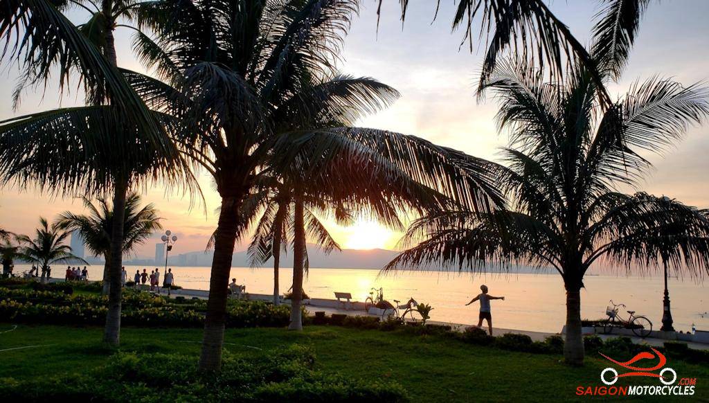
Quy Nhon is the best beach city in Vietnam in my opinion. A beautiful beach with a well kept parkland to accompany it. This is the dawn not to miss. From first light it is a vibrant area as the local dance groups, elderly and young alike exercise and swim in the dawn. I’m most often the only Westerner there and by 6.30am it’s all over. Get at it!


The map reads at 283 km but it’s only that if you want it to be. There’s a few detours that add nearly 80km. The longest is to check out a couple of lakes that you can decide on depending on time. Once you turn onto Truong Son Dong it gets quite isolated and you’ll make good time. Make sure you are fueled up and take water. Not much in the way of services through there but a cracking ride. The hotmix when you turn left to Mang Den is the best in the country.

(A) is a Buddhist Temple

(B) a hydro dam wall
(C) is the airstrip back in the supply trail days
(D) to check out the Vinh Son Lakes
(E) the Kon Chu Rang rangers station
(F) there is bottle fuel and cold refreshments
(G) a great little coffee shop ++
(H) Mang Den is a unique village in Vietnam and the Dak Ke Lake makes a nice morning walk.


(I) is a hidden gem. My favourite place to stay but book early. Not too many rooms.


Log in below to view full route maps, accommodation and food information.
These are supplied to all our touring bike customers.
(Excluded from the above itinerary)
Mang Den - My Khe
Distance: 150 kms
There’s not too much in the way of attractions on this ride though for me the whole ride is an attraction. Shorter in respect of distance and for anyone wanting to make up a day easy enough to continue on up the coast to Hoi An or Da Nang.

To Veo Lac this morning is an exceptional track. For those on big bangers as good as it gets. Can be hard on footpegs and exhaust guards 🙄
Plenty off this map to explore if you want to fill the day up particularly for those on XR’s or smaller capacity adventure bikes. I take my Multistrada anywhere but it can be challenging, especially in the steep mountain areas.

(A, B, C & E) today are scenic areas for photo opportunities or just to suck it in.
(B) is a great view over the valley where you are about to ride in the foreground.

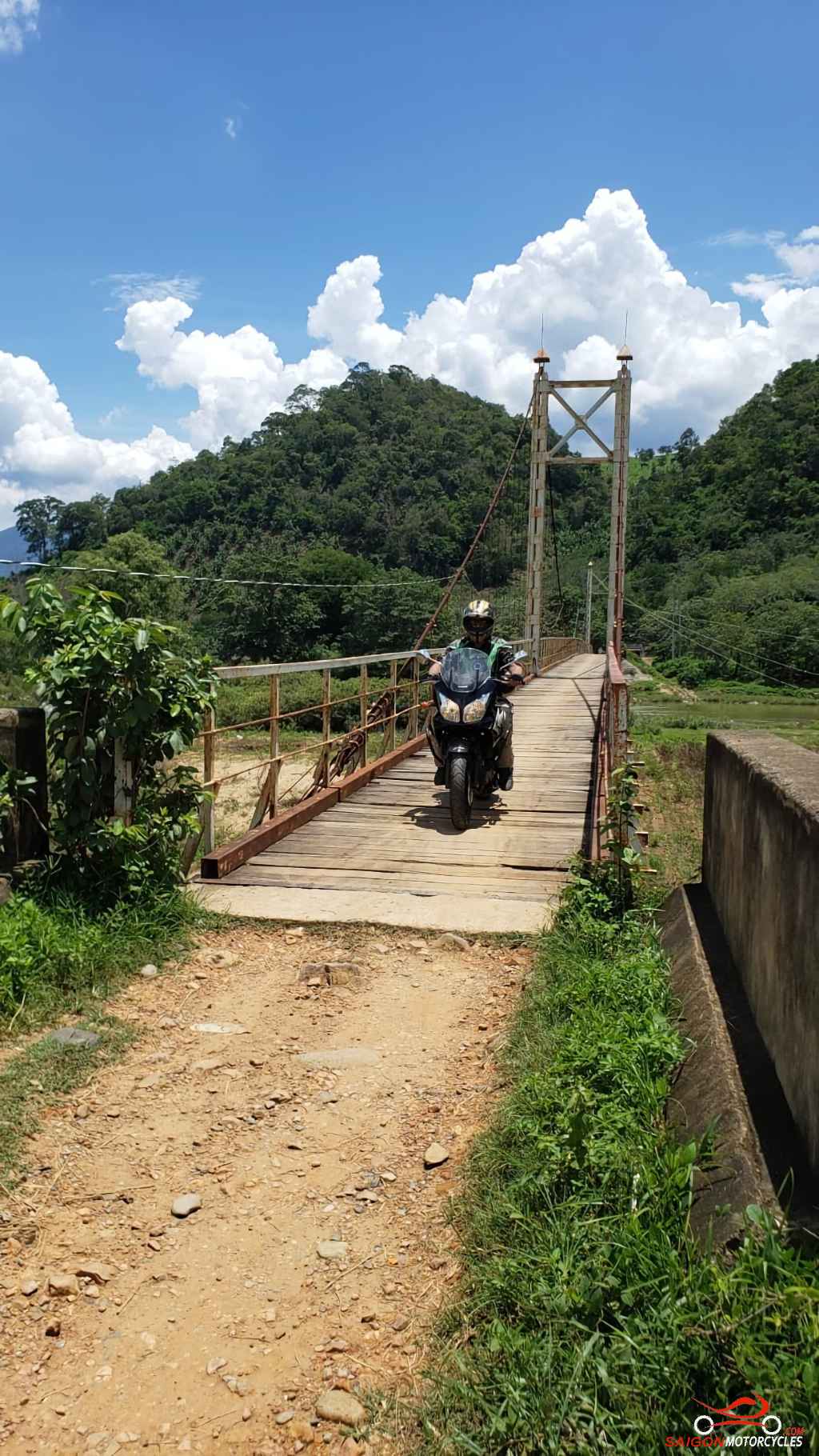
Once you get off the range for the more adventurous (D) will divert you to a minority road and through some lovely village country. This bridge is the entry if you turn a little earlier. Much more interesting through there. Some unsealed sections but at the rate the concrete is going down will be all paved before long.

Once into My Khe you’ll notice plenty of fresh seafood restaurants along the beach road. I find them expensive and the beer is never cold. The restaurant attached to the hotel is as good as any for my money. It’s a lovely beach and a great place to be up at dawn. This sunset I shot with my drone shows just how narrow the land passage is between the river and beach.

Log in below to view full route maps, accommodation and food information.
These are supplied to all our touring bike customers.
(Excluded from the above itinerary)
My Khe - Hoi An Inland
Distance: 250 kms
In terms of distance this is a short day and a pleasant uncomplicated ride. 20 kms longer if you continue up the coast to Danang.
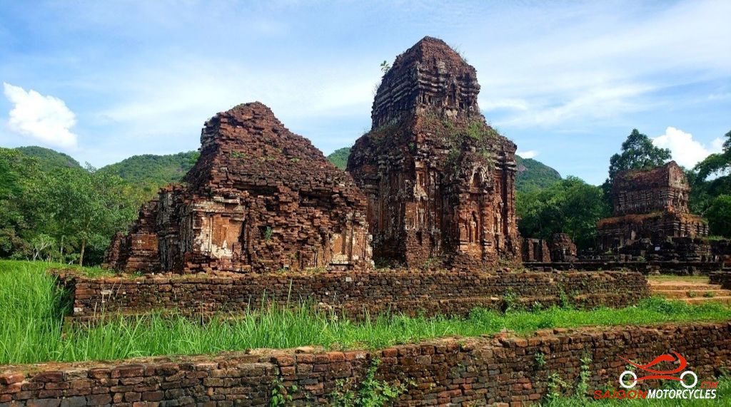
If Hindu ruins are of any interest to you it can be a very big day though. I’m not much for pagodas and temples so choose to visit only the more elaborate and famous but I do find My Son interesting. You can literally spend hours exploring the various sites.

Some interesting stops of interest along the way but My Son is the area to spend the majority of your available time.
(A) if you get away early is a great coastline vantage point.
(B) a war museum but really just marked to get you the best way out over the A1.
(C&D) a few nice waterfalls and nature walks in this area. Bit of time required to get the best of it.
(E) some decent local food stops in this area
(F) My Son Group is a World Heritage listed archeological site. These Hindu temple ruins date back as far as the 4th century and in my opinion a must do. 150k entry fee and surprisingly very few tourists generally.
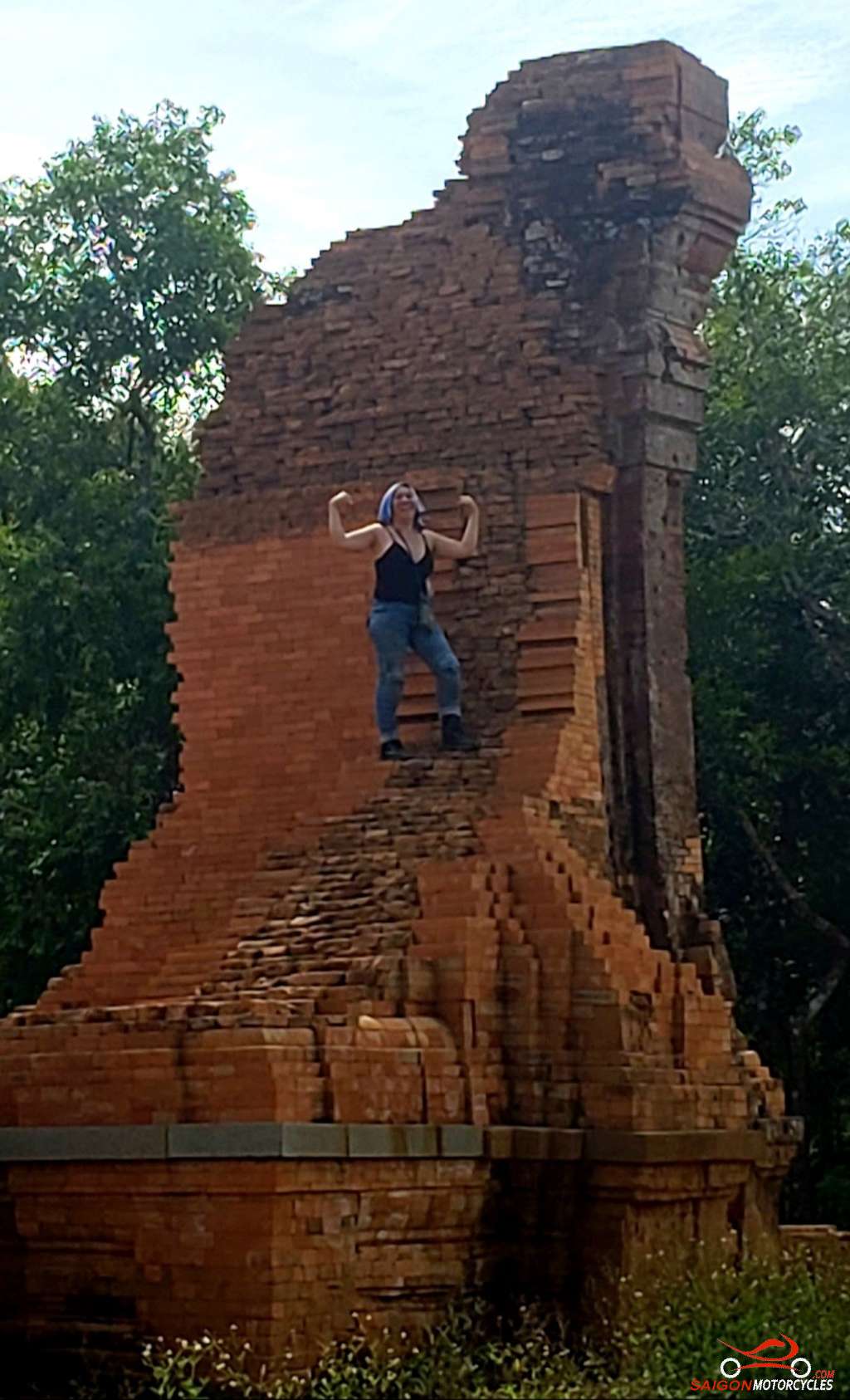
A golf cart takes you to site from the entrance then on foot and it can be hot so take water. The parking guys will mind your helmet and jacket. No Drones allowed apparently 🤫

Many restaurants around the area offer Be Thui. Rare cooked Veal wrapped in leaf with vegetable. Quite a treat and not often offered.
From there its a simple ride into Hoi An or Danang to your preferred accommodation. The maps destination is a very nice Aussie owned Boutique Hotel.
Da Nang - Hue
Distance: 180 kms
This is a relatively short ride day so no time pressure to get at it early. The early riser though, is regularly rewarded with a beautiful sunrise on busy beaches.

One of my preferred morning beach cities for the vibe. Several ladies in their dancing groups mixing exercise with social entertainment.

For those who get at it early, the morning views from the Monkey Pass over Danang City and from the Hai Van pass of the ocean are quite spectacular so long as there is no low cloud.

For those on automatic transmission scooters delete (A, B & C) as they are now allowed on the Monkey Pass.

You need to be aware that trucks carrying flammables are not allowed in the tunnel so run over the pass. This is less frequent now with many using the expressway around behind the pass.

(D) Is the coffee stop at the top of the Pass. Plenty of sellers there with souvenirs etc. Some fortresses too, battle scarred from gunfire to hold ground between the North and South historically.

Some nice views coming off the pass on the North side too but keep focused on the job and park safely for photography.

(E) Is your seafood lunch stop right on the beach. A few options in the area. All good, but this one has western seating and always been happy with the food.

(F) Don’t miss this detour. One of the nicest secluded beaches in the country. Pack a picnic and this would be a unique lunch stop option.


(G) Is a museum but marked on the map more so to take you up through burial grounds with tombs dating back the the Nguyen Dynasty

A sunset boat ride up the Perfume River is a nice finish for the day and relatively inexpensive.
Equally as good is the sunrise coffee and the river boardwalks to start the day.

Hue (formally the Imperial Capital of Vietnam) is my favourite river city in the country. Around 1.8M people reside here and it has a huge amount of ancient and more recent history.

The Citadel (The Imperial City), right in town was the Kings residence in the Nguyen Dynasty. Worth the time to do it but If it’s a hot day, take plenty of water. I find with the high perimeter walls it can get uncomfortably hot in there.

Log in below to view full route maps, accommodation and food information.
These are supplied to all our touring bike customers.
(Excluded from the above itinerary)
Hue - Khe Sanh
Distance: 195 kms
Get down to the river early. It’s a nice vibe with the locals exercising along the boardwalk and fisherman beating the sun in their open boats.


This isn’t a big day travel time wise but you can burn some time at the stops. A nice early start following the Perfume River out of Hue.


(A, B & C) are all historic points of interest. A good coffee stop right in front at the left turn up the top.


(D) on the map is Hamburger Hill, the site of a significant battle offensive in May 1969. There is a memorial at the top and a number of other sites off the main track.


It’s quite a climb and as I understand it you are supposed to have a guide although I did it by myself. Adds only 15 kms to the day but some time. Take water if tackling this.

Even if you decide against the climb it’s a great area to go exploring off this map in any case. I went alone the first time and all went okay but very remote so I advise sticking to the main tracks if by yourself.


From there we meet up with the HCM Road and follow the Thach Han River. Some really nice swim and photo opportunities along this stretch.
(E) on the map the best of them.


(F & G) again historical sites keeping you on the right path.


(G) is the US Military Combat Base. Opens at 7.30am if you get in late and well worth a look for the modest entry fee. Quite a bit to learn there if you want to commit the time.


Log in below to view full route maps, accommodation and food information.
These are supplied to all our touring bike customers.
(Excluded from the above itinerary)
Khe Sanh - Phong Nha
Distance: 230 kms
This is not a huge day distance wise but will take longer than you think. With an early start you’ll get it done comfortably at a relaxed pace though. This stretch of the Ho Chi Minh Road is quite simply a must do experience in this country. Mostly a raked concrete surface with plenty of grip but hard on tyre’s and challenging in places if riding spiritedly. Landslides are common through here so be mindful of sand or clay on corners. My favourite ride day between Danang and Hanoi.

These days there is fuel available about half way but as always a good idea to fill before you leave and take water. There’s not too much in the way of services through much of this.
These days there is fuel available about half way but as always a good idea to fill before you leave and take water. Not too much in the way of services through much of this.

(A) The US Military Combat Base. Opens at 7.30am and is well worth a look for the modest entry fee. Quite a bit to learn there if you want to commit the time.

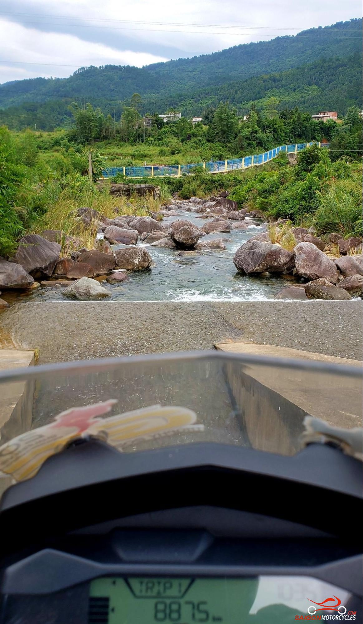
(B & C) are nice swim spots well located for rest stops.
(D) a good photo stop.
(E) one of few accommodation options if you wanted to break it up.
(F) another photo stop and
(G) a higher end accommodation option in the village on the river.

(B) This waterfall is my swim stop but better located when running this road South. A bit early in the day North bound but a great photo stop in any case.
(C) A roadside waterfall which in wet season particularly is a well located rest and photo stop.

(D) Always a stop here, one of very few intersections if leading others to group up. A historic milestone marks the corner and if you take left you’re off to the coast.
(E) Historically decent food on this ride has been hard to come by but Ms Thu at this well set up roadside cafe has got us covered these days.

(F) In recent times this hotel is an option in the unlikely event of a bike or health problem. I’ve never used it but now nice to know there’s something if needed.
(G) One of many caves in the area if you want to add that to the day. I’m usually to focused on the road to bother but it is a good rest stop.


(H) Phong Nha – Ke Bang tourist centre to pick up a souvenir of the area maybe on your way out or a boat for a run through the Phong Nha Cave.

(I) Is my go to out of town on the plain. Well appointed comfortable ensuite hotel rooms to pool villas with a well stocked bar, great pool and an extensive menu. Ben and Bich the hosts have great local knowledge and work hard putting together activities for their guests.

Phong Nha township on the banks of the Son River is part of Phong Nha-Kẻ Bàng National Park, a UNESCO’s World Heritage Site
The area has developed in recent years as a popular tourist destination.
Attractions include numerous caves to explore. Phong Nha Cave a leisurely river cruise though caves under the mountains and Paradise a little more traditional dry cave are cheap and readily accessible. At the high end Hang Son Doong is reportedly the world’s largest cave with its own very unique ecosystem and a four day commitment, far from cheap to explore.
Also of note the limestone and bauxite monoliths rising from a vast floodplain to the North, were the land sections in the filming of King Kong. This area is a great motorcycling day loop from the township.
Log in below to view full route maps, accommodation and food information.
These are supplied to all our touring bike customers.
(Excluded from the above itinerary)
Phong Nha - Gio Lao
Distance: 300 kms
This looks like a big day but really it isn’t. Open deserted roads so you’ll make good time. Unless coming off the HCM Road the accommodation options today are pretty thin so it’s worth an early start and get it done.

The road into the Laos border is an absolute beauty. Don’t miss that 38k’s each way but obviously by letting it slide you’ll shorten the day significantly. Plenty of trucks, mostly pulling ore out of Laos so you need to be mindful of that. As the photo suggests, not all get it right.

Once back on Uncle Ho’s Road it opens up and is a bit of a transit leg comparatively to your night stop.
(B) The pick up point for a boat tour around the tea farms.

Weather permitting, it’s a pleasant experience and not expensive. I’ve been a few times and never crowded.

Great drone area too. This is one of my favourite low level shots.

Log in below to view full route maps, accommodation and food information.
These are supplied to all our touring bike customers.
(Excluded from the above itinerary)
Gia Lao - Tam Coc
Distance: 300 kms
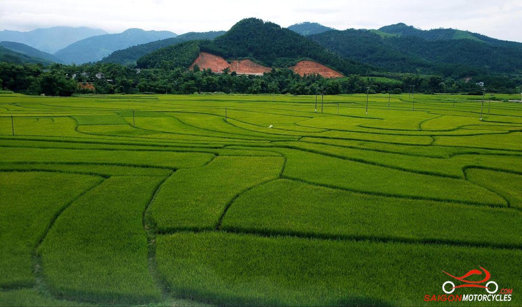
A reasonable sized day distance wise but easy as it’s not as big a day scenery wise, therefore photography wise. Compared with where you’ve come from and particularly where you may be going the country flattens out a bit in this section so with that higher average speed.

If you don’t have time for a day off in your schedule, get an early start tomorrow to be in mid afternoon. The Tam Coc area is worthy of a good look around. Besides, a dawn start every so often is good for your soul.

(A) a good morning coffee option
(B) is the HCM Trail 0 milestone. Good first photo and rest stop.

Plenty of good food options along the way as always. Where restaurants are over water you can be sure of good seafood even this far off the coast. Alive in tanks so no question around freshness.

(C) is a massive sunflower farm that at certain times of the year is quite spectacular.

(D) is just keeping you on the right track
(E) is an interesting place to check out. A lot of this 13th century Imperial Fortress is in ruins but the gates I imagine rebuilt are pretty impressive. Have a good look around and leave through the East gate to pick up this map again.

(F) another tour option you could bypass if time poor
(G) a great accommodation option perfectly located

It is at the end of the village so an early morning walk through the rice paddies and mountain area is recommended. Having a flick for a fish is good fun.

(H) The Caves boat tour is a must do.

The best of many tours offered in the area if having a day off here or in early enough to squeeze it into the afternoon. Last boats leave at 3.30pm for the full 3 hour tour.

While the lady paddles down the back, relax and enjoy this beautiful part of the country. Of note this is the area the water scenes for King Kong movie blockbuster were shot.


Log in below to view full route maps, accommodation and food information.
These are supplied to all our touring bike customers.
(Excluded from the above itinerary)
Tam Coc - Pu Luong
Distance: 170 kms
Tam Coc Garden is perfectly located to enjoy the dawn with a morning walk or ride. The walk out the back has a cemetery and some beautiful mountains perfect to throw a drone up. The dawn over the rice fields pretty special.

(A) If opting for a short ride, out to the main road but turn left rather than into town and you’ll come to a dead end where there’s a temple and a coffee lady.

Another great drone flight up over the mountains behind the temple and along the ranges back toward town.

(B) gets you on the best run out and starting point of the best Caves tour in the area.

The morning ride is a pleasant one following the Hoang Long and Boi River systems to Uncle Ho’s Road. Shortly after crossing provinces you turn right and follow the River to this awesome Waterfall.

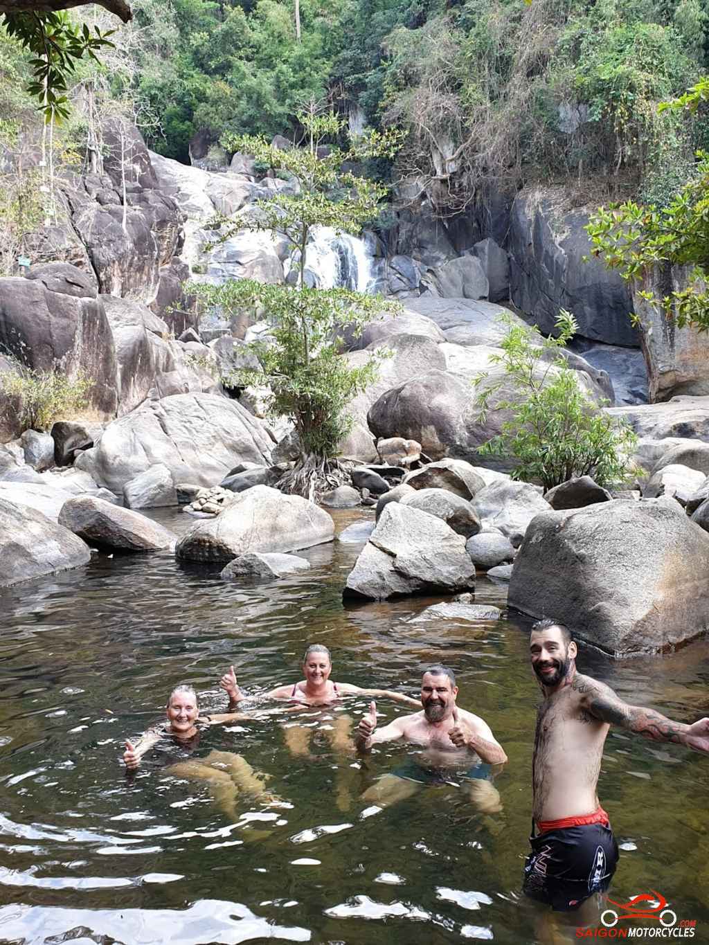
(C) Across from the entrance is this lady who will look after your bike, organize beers and cook lunch while you’re having a swim. Ask for running chicken, hubby goes off, catches it and it’s barbecued by the time you get back. Tougher than normal chicken but delicious and local to the mountain country.

Can change into your swimmers there and make sure you do. There is something about this particular waterfall that just feels different to others.

(D) is another great lunch option before the afternoon ride. Beautiful through the mountains as you start to realise you are getting more remote.

(E) another great swim spot but both recommended night options have awesome pools so easy to miss this one.

(F & G) are my two favourites of many over the years. More on that in accommodation options.
One of the really great areas in the country and this day for me day one of three absolute beauties. If you have time to stay some great loops in the area also. Sunrise even with low cloud is still okay from Gurties perspective.


Log in below to view full route maps, accommodation and food information.
These are supplied to all our touring bike customers.
(Excluded from the above itinerary)
Pu Luong - Hoa Binh Lake
Distance: 95 kms
I thought I had the mapping from Pu Luong to Ta Xua pretty nailed until I explored this option late last year. We went right through to Bac Yen but this is the way I’ll do it next.

The morning ride through the nature reserve and then up the range is sensational.
(A, B & C) All great view points. The views back over the valley are as good as it gets.

Some interesting riding on the plateau too as very basic living standards and farming techniques.

Later in the morning you’ll encounter the Da River for the first time. As you enter the lakes area the beauty takes another twist. The riding around this lakes area very special. More brilliant drone country.

(D) The Go Lao Waterfall on Hoa Binh Lake is another great swim opportunity and possibly could again coordinate it with lunch if the timings right.


(E) After you check in, possibly as it’s an overshoot, is a great sunset viewpoint.

(F) There are plenty of cheaper options in the area but if you want to spoil yourself this is one of my favourites. Not cheap but so worth it.


Log in below to view full route maps, accommodation and food information.
These are supplied to all our touring bike customers.
(Excluded from the above itinerary)
Hoa Binh Lake - Ta Xua
Distance: 155 kms
155 km up with my favourites today. Not a big day distance wise but tight so still a full enough ride with plenty of photo opportunity and wow factor.
(A) is a waterfall very close to your accommodation. The first view where I took this shot. The path down is around the next right turn.


(B, C, D & E) Are all waterfalls. Unless you have a waterfall fetish you probably won’t do them all. Drop (D & E) possibly.

(F) The ferry crossing where you revisit the Da River is a safe and pleasant experience.

(G) The road up to Ta Xua from the Village is a bit broken up in places but almost no traffic so you have plenty of space to smooth it out. You’ll see lots to keep you entertained in this wonderful remote part of the North West.

Loads of accommodation options these days but (H) is the best of numerous I’ve tried over the years.

(I) The Dragon Spine at sunset or sunrise is spectacular. Worth the walk if not the ride.
My first ride to the end of the Dinosaur Spine still rate’s as one of my most memorable adventure day rides ever but not without risk. To get to the end (second photo) you have a 30 metre section around 30cm wide and a sheer drop both sides!


Also overlooking the spine and this wonderful valley don’t miss the pork skewers. Delicious.


Log in below to view full route maps, accommodation and food information.
These are supplied to all our touring bike customers.
(Excluded from the above itinerary)
Ta Xua - Dien Bien Phu
Distance: 275 kms
You don’t remember every breakfast but you will remember this one. Lots on offer but the hot coffee and skewers take a bit of beating.

Can be fogged right in early and you may want to get on the move before the sun burns it off but the local kids with the cattle women doing the cooking make it quite an experience.


Other mornings if there was a heaven this is what it looks like.

If I’m staying an impromptu day this is it for me and happens often. Such a hard area to drag myself away from.


First up backtracking off the mountain to the village in the valley some areas may be under heavy cloud. Take it easy as the surface is also broken in places.

Then rather than the main road we wind along the river on a great road to meet the main arterial to Son La for lunch. Got a bit chilly last time through there so kitted up!

You’ll see ladies in this area with perfectly groomed hair buns. They are married. If their hair is down, available. These ladies wear their riding cap on top of the bun with extended straps. Some actually get a pod for the bun to fit in riveted into the helmet. Hilarious!!

The road to Dien Bien Phu from Son La is one of the greats. Wide sweeping and heaps of grip. If you’re not getting the pegs down there you won’t anywhere.

I haven’t got the exact location of this photo for some reason but if you spot it on the right hand side just before a left hander had great views and friendly people for a refreshment break.

(G) Is a good clean and tidy hotel. Nothing much has excited me over the years here so if you find a gem let me know.
(H) Is the morning walk.
Log in below to view full route maps, accommodation and food information.
These are supplied to all our touring bike customers.
(Excluded from the above itinerary)
Dien Bien Phu - Sa Pa
Distance: 338 kms
Although this reads at 338 kms, 60 kms is cut off if you don’t take the hydro dam detour. The ride is pretty open so with an early start you should be able to do at least some of it comfortably.

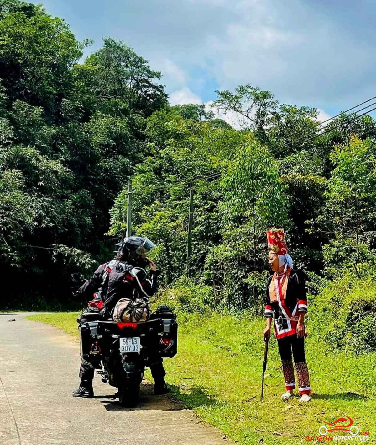
You’ll see many Muong Villagers in traditional dress out of town. Unfortunately in recent years this in tourist areas has become very commercial but out here genuine country people .

(E) On your way into Sapa, Mount Fansipan, Indochina’s highest peak really is a sight to behold if the weather is right.

Probably worth a hotels search here with so much on offer. I’ve stayed in a variety of accommodation but if your budget allows this is my favourite. Location, views and awesome views from an exceptional pool.


If you are planning to explore Sapa and would like a guide I highly recommend A, pronounced ‘Ahh’ – 0947 360 557, WhatsApp also. Lovely girl, native to the area with great English and a sense of fun.

Log in below to view full route maps, accommodation and food information.
These are supplied to all our touring bike customers.
(Excluded from the above itinerary)
Sa Pa - Hoang Su Phi
Distance: 260 kms
The early run out of Sapa to Lao Cai is a pleasant descent. A very busy stretch though running visitors to various transport options including the overnight train to Hanoi. Patience is required as the bus drivers have none.

You may get a photo at the China Border as your first stop.

For the next few hours we keep a view of China on our left much of the time. The mountains are sensational as is the riding.

(A) is a waterfall well placed for a break just before one of very few villages we pass through for the day. Nothing much in the way of attractions at all really but for me the whole ride is one ongoing attraction.

(B, C & D) keep you from straying. Some harsh country up here. You’re not too far from China in this section.

(E) A great coffee or food stop with this view. The food and people very good.

(F) A basic but clean and well managed hotel I’ve used a few times if you want to pull up short.

Coc Pai is a wonderful little riverside village in a deep valley. The road into it is steep in places so a bit of care in that area. I had my only bike issue touring in Vietnam here in 2020 so learned a bit about the place with my extended time there.

The road quality takes a dive after Coc Pai as does our average speed. Plenty of off rides in this area if time allows but don’t worry the map is on the hardtop as much as possible.


I rode through here in the wet a few years and where the road had been cut out of the mountains literally 100’s of small waterfalls were created. As spectacular as that was I prefer it in the dry.

Log in below to view full route maps, accommodation and food information.
These are supplied to all our touring bike customers.
(Excluded from the above itinerary)
Hoang Su Phi - Dong Van
Distance: 260 kms
The early ride to Ha Giang is pretty simple and as always best to get away early. Today is a photographer’s wet dream so lots to take in. Watch your speed around Ha Giang. The police are used to tourists, speak English and are very friendly but do it by the book. 700k my biggest fine ever 60 in a 50.

(A) A waterfall and early coffee stop.
(B) Out the North side of Ha Giang, Bac Sum Pass is another good stop for a break and food if you’re ready with a view tower for photos if the weather is clear.


(C) Just up the road is this popular coffee stop with great views. This is a high motorcycle tourist area and part of the well marketed ‘Ha Giang Loop’. Mostly foreigners and most inexperienced so take care around them.


(D) Plenty of great riding today and this is mapped to get you on the best of it. Nothing technical but exceptional in all aspects.

(E) Is one of the viewpoints to this rather famous section of road.


Drop (F & G) off this map to cut 30km off if short on time. Can back-track to the Northern most point tomorrow with an early start.

(H) A great panoramic view and where you will turn for the descent into Dong Van. In wet conditions particularly lots of leaf litter on this section can be hazardous if unaware.

(I) My favourite of the accommodation I’ve tried here. Plenty on offer these days though.
Log in below to view full route maps, accommodation and food information.
These are supplied to all our touring bike customers.
(Excluded from the above itinerary)
Dong Van - Meo Vac
Distance: 120 kms
This is the best riding day in Vietnam in many ways. Interesting, challenging in places, and just beautiful. Not a long day but it will take time. If continuing through to Cao Bang get away early.
This is a memorable day ride full of panoramic city and ocean views. To get away at dawn is very special on the right day.

(A) Lung Cu Flag Pole is a box tick that is well worth doing if you bypassed it yesterday.

The stretch into (B) is a fantastic narrow wind that doesn’t go anywhere in particular. To some chickens in someone’s yard actually. Challenging but not dangerous and great views.


(C) This monument is in memory of the lives lost in the building of the happiness road. Right next to the entry to the skypass.

This next section is together with the ‘Dragon Spine’ at Ta Xua the most potentially dangerous rides here. If in doubt, delete (D & E) and stay on the main road. In 2023 they didn’t let me up there so might not even be an option any longer.

(D) to (E) extends right through to the main road though Google doesn’t show it. This is an awesome ride. The views are magnificent but in places not for the faint hearted. It isn’t technical but you need a clear head. A mistake in the wrong place could be rather final. If not riding it consider walking to the view point.


This photo I took from the top of a sketchy side path I took off the ‘Skypass’ a few years ago. One of my absolute favourite shots and one very few would have.

(F) Once back on the main road the Panorama Cafe is a good spot for a break. The views from there are also epic.

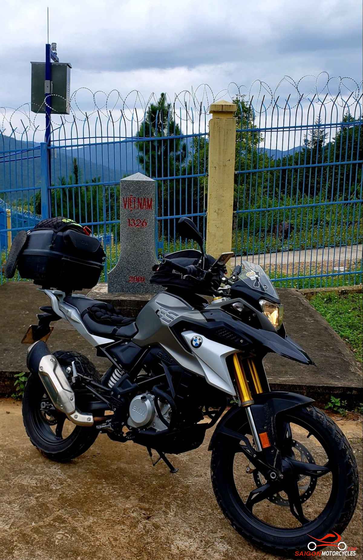
(H) This bypass anyone can safely do and should do. Sealed, wider and awesome. There’s a few view points but keep at it until these boys in green tell you you’re close enough to China.

Meo Vac - Cao Bang
Distance: 198 kms
Meo Vac is the mountain city, for some reason, I feel a bit drawn too. I’ve always had a good night there but always very different.
The morning walk is peaceful and the surrounding countryside up with the best in the country.

This is, in itself, another cracking ride day but hard to be amazed after the enormity of the previous two days.

More of the same you could say although not on the tourist trail so local traffic only even pre Covid. Tours are either through Ba Be Lakes to Ban Gioc or to Sapa, Ha Giang and the flagpole. Nothing much in the way of attractions but for me it’s one big attraction.

If heavy rain always be mindful in areas with steep cutaways of falling rocks or worst case landslides. Especially where you start to see a few rocks on the roads. The two passes marked on the map are crackers but don’t get off map today. Pretty harsh country.

(A, B, C & E) are photo pins on this map and to keep you going the right way.
(D) I haven’t spoilt with a photo but you’ll know it when you see it. Amazing!


Log in below to view full route maps, accommodation and food information.
These are supplied to all our touring bike customers.
(Excluded from the above itinerary)
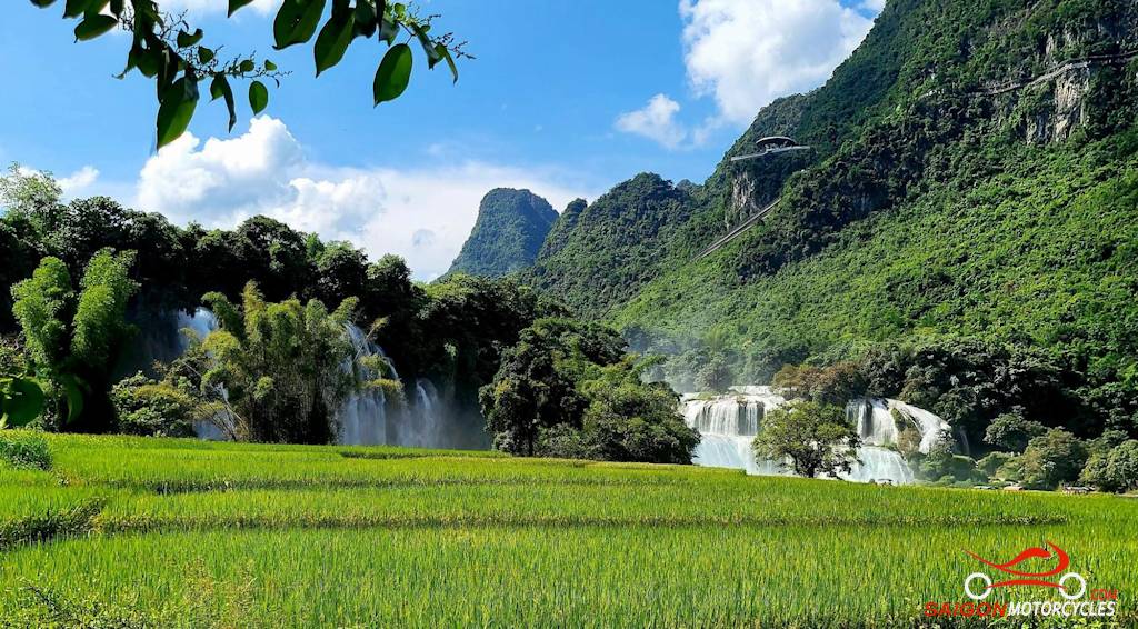
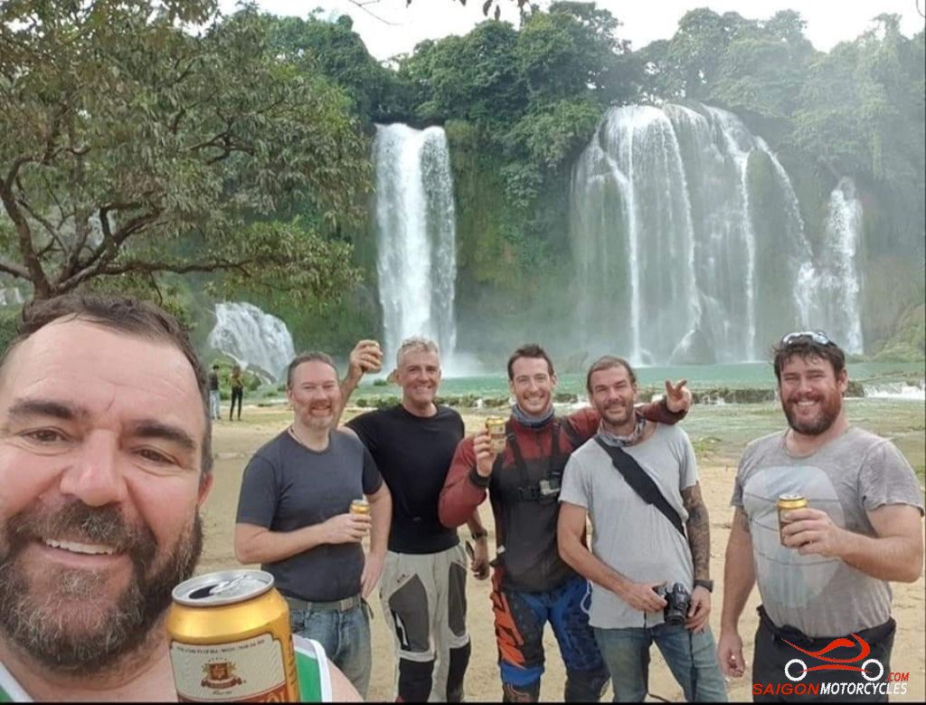
Cao Bang - Ban Gioc Waterfall Return
Distance: 192 kms
This is a really fun day, especially with a good crew. The ride is pleasant but not challenging. The roads are more open and the speed considerably higher so you’ll make good time. I recommend an early start though because you can spend hours enjoying the off time.
(A) This first detour is worth it. Wasn’t brave enough to run the drone through the middle but doable I think if a bit closer to it. Get it wrong though and the final flight for sure.
(B ) An interesting stop with the first swim opportunity for the day.
(C) Is a viewpoint and a great photo opportunity.

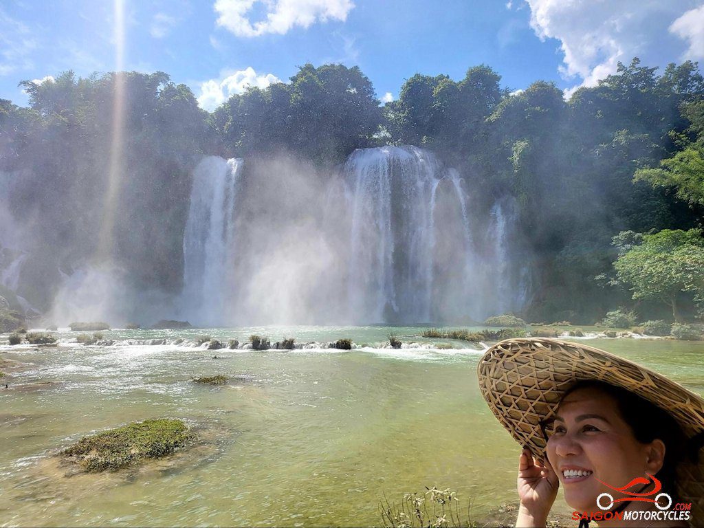
(D) The enormity of the falls is quite amazing. The visual the first time you see them has quite a bit of wow factor. Even in the dry season I doubt you’ll be disappointed.
My first time there with this wild mob was, shall we say, memorable. As was that entire tour actually.
There’s plenty of food and beverage on offer so allow plenty of time at the falls. Also a lot of cool souvenir sellers if you want to take something home.

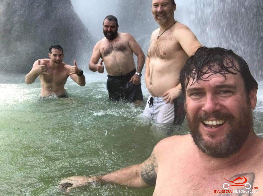
There are no swimming signs everywhere but we decided this didn’t apply to Aussies. These photos are my first time and swam every time since. The sound and the power of the water off the falls is very impressive. An experience not to be missed.

There are guards with whistles but this Aussie mob have bad hearing and they gave up. Busy stopping others trying to follow our lead though.
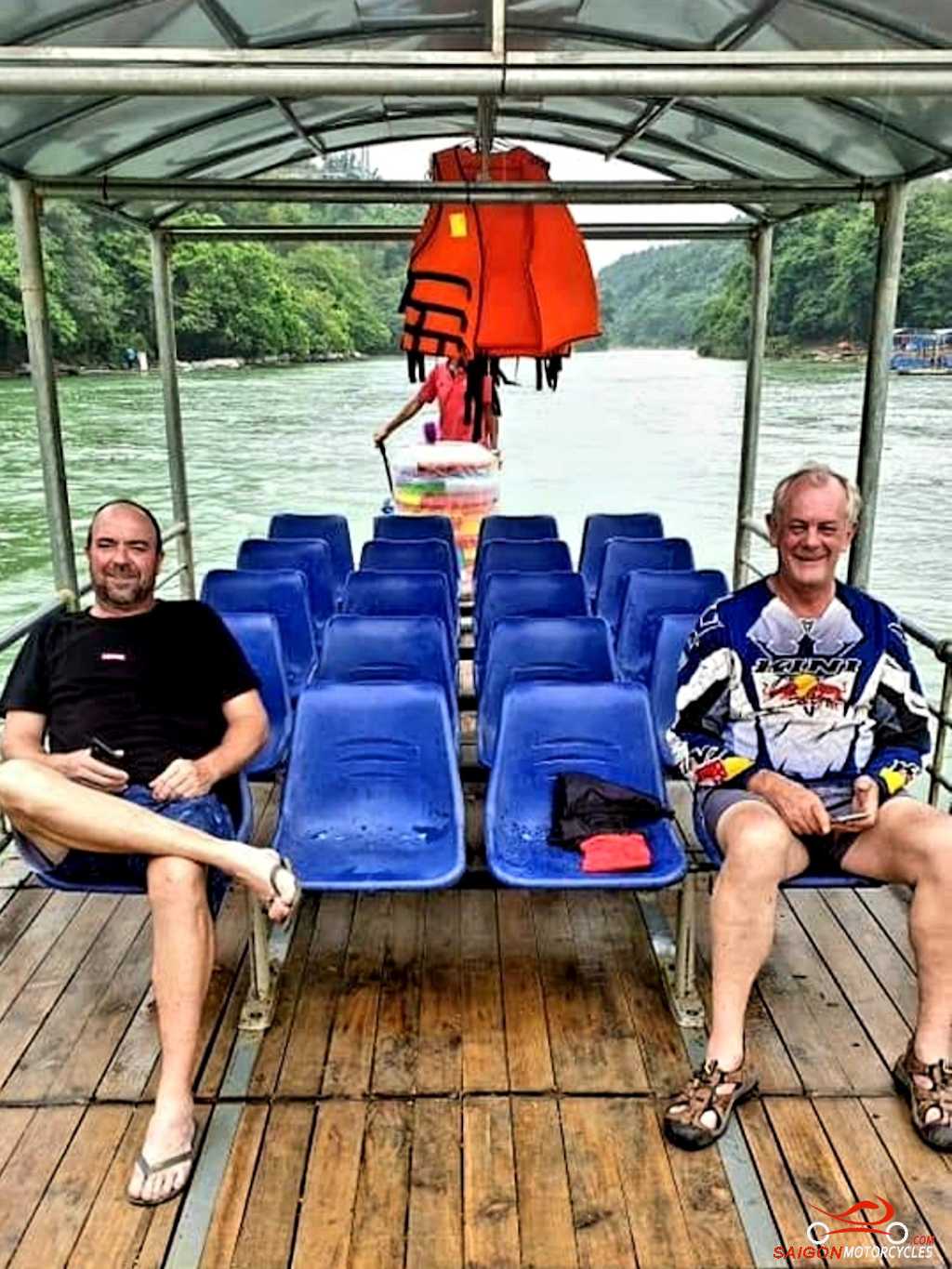
Tourists are well catered for with activities. There are tourist boats on both the Vietnam and China side of the falls. The boat ride too, worth the minimal fee.


I’ve got you on a loop and the run back is an excellent part of this ride. We start following the river which is the China border then for many maybe in over a month the first time you turn to head South.
(E) is a great viewpoint but not this one pictured. You will ride through it and a big surprise for me the first time I approached it. Not something you see everyday.

(F) back to town and my usual accommodation choice.
Log in below to view full route maps, accommodation and food information.
These are supplied to all our touring bike customers.
(Excluded from the above itinerary)
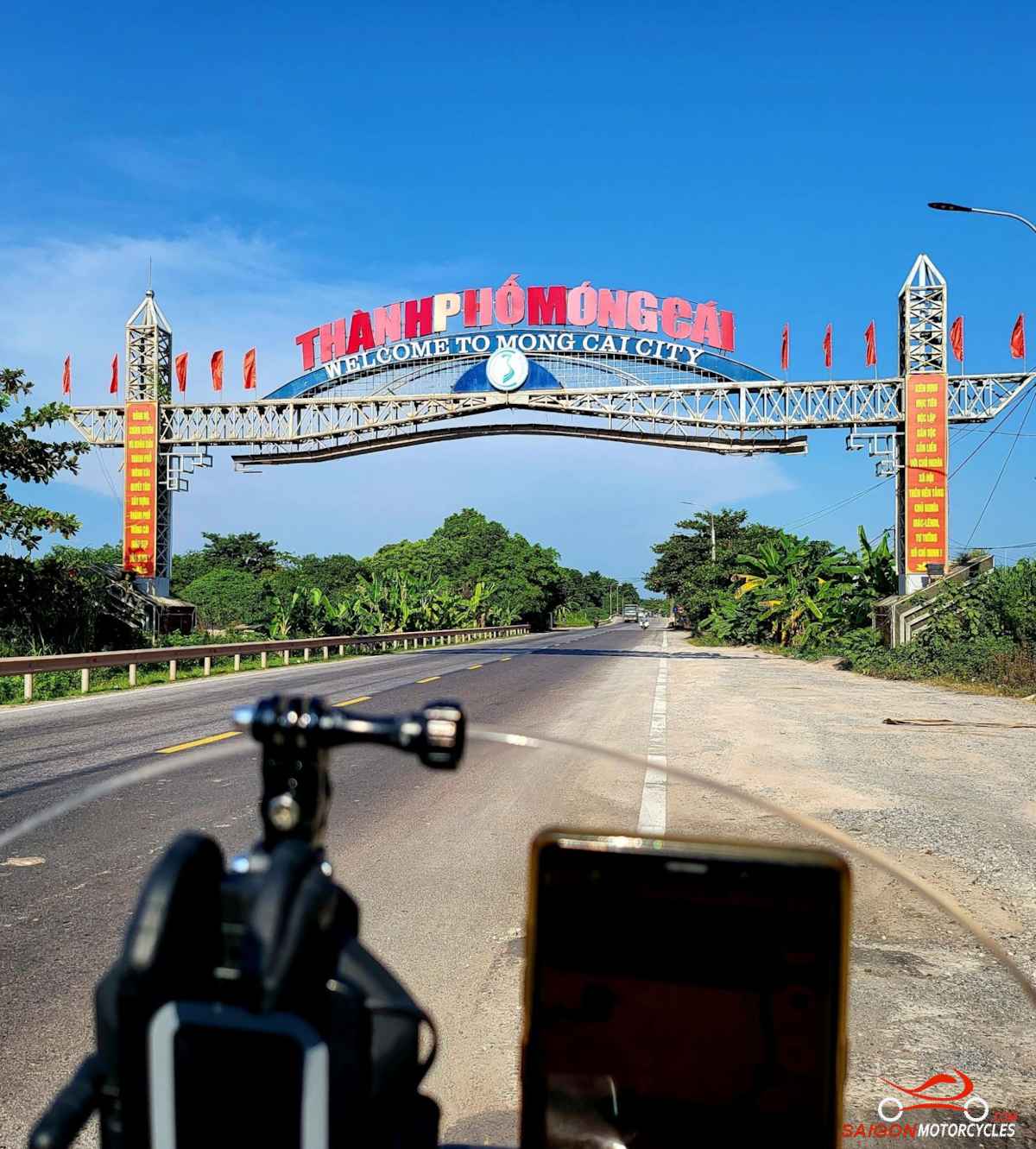
Cao Bang - Mong Cai
Distance: 340 kms
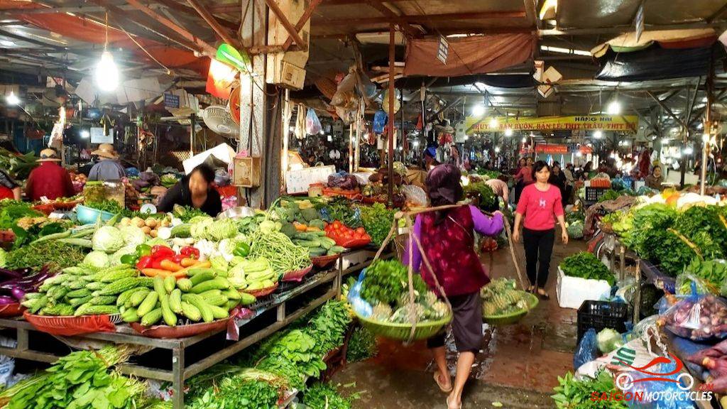
Everywhere we go there is a morning market of some kind. Cao Bang market on the Song Bang river is one of the best in the country. The morning walk around it and along the river is very entertaining. Ironically the other market to rival this is in Ca Mau at the polar opposite end of the country.
This ride looks pretty ordinary on the map compared to the tight stuff we’ve been doing but is in reality very sweeping and perfect on the bigger bikes.
Once on the border road the minority people are easy to spot and interesting in their unique native clothing.
You’ll be literally following the border fence with a view to a very sparsely populated area of China.
(D) is this great border landmark well hidden for a photo with your trusty steed.
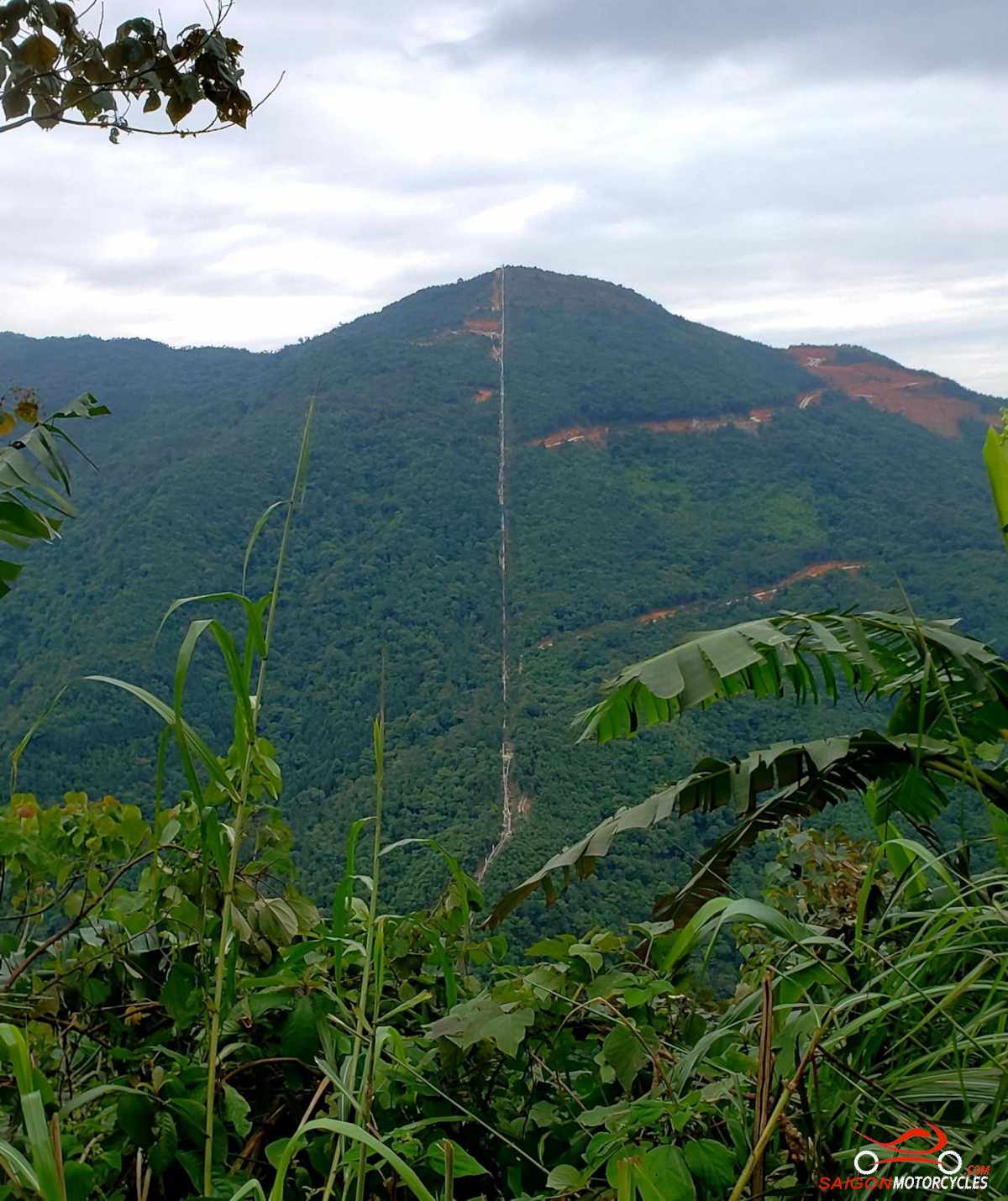
I don’t fly my drone near the border but this elevated area on the border track shows the fence and the cut in’s through the bush to build it on the Vietnam side. Not hard to work out who is keeping who out!
It’s a big day but you’ll make good time early. The border run later is slow going so very early start or break it into two days.
(E) is a war museum. If you drop (D & E) you can go straight to Mong Cai and run the border track tomorrow on your way to Ha Long
(F) A hotel I’ve used a few times well located but plenty of choice in accommodation options.
(G) The main border crossing. This shot was taken during Covid. Very different now with the border open. The Chinese investment is obvious, clean and modern.
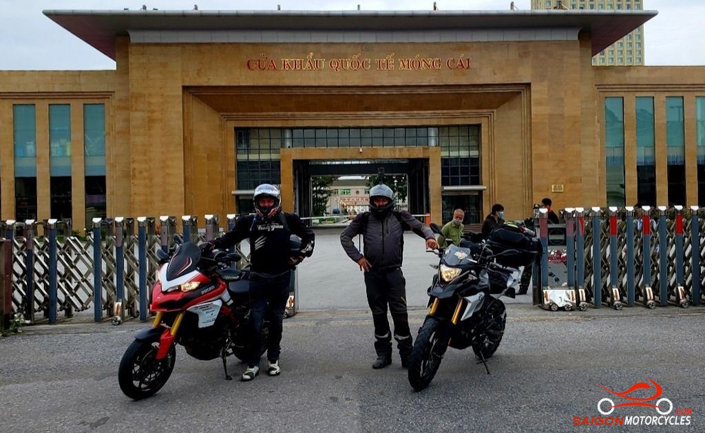
Also this one during the Covid closures but still found a few interesting places open for a beer all be it a bit deserted.

Log in below to view full route maps, accommodation and food information.
These are supplied to all our touring bike customers.
(Excluded from the above itinerary)
Mong Cai - Ha Long
Distance: 250 kms
We’ll start the day with a ride out the peninsula with a view to China’s Beibu Gulf.
(A) Security were a bit precious about my being there last time but worth a look. The Northernmost coastal point and just pipped by Mui Doi on the peninsula North of Nha Trang for Easternmost.

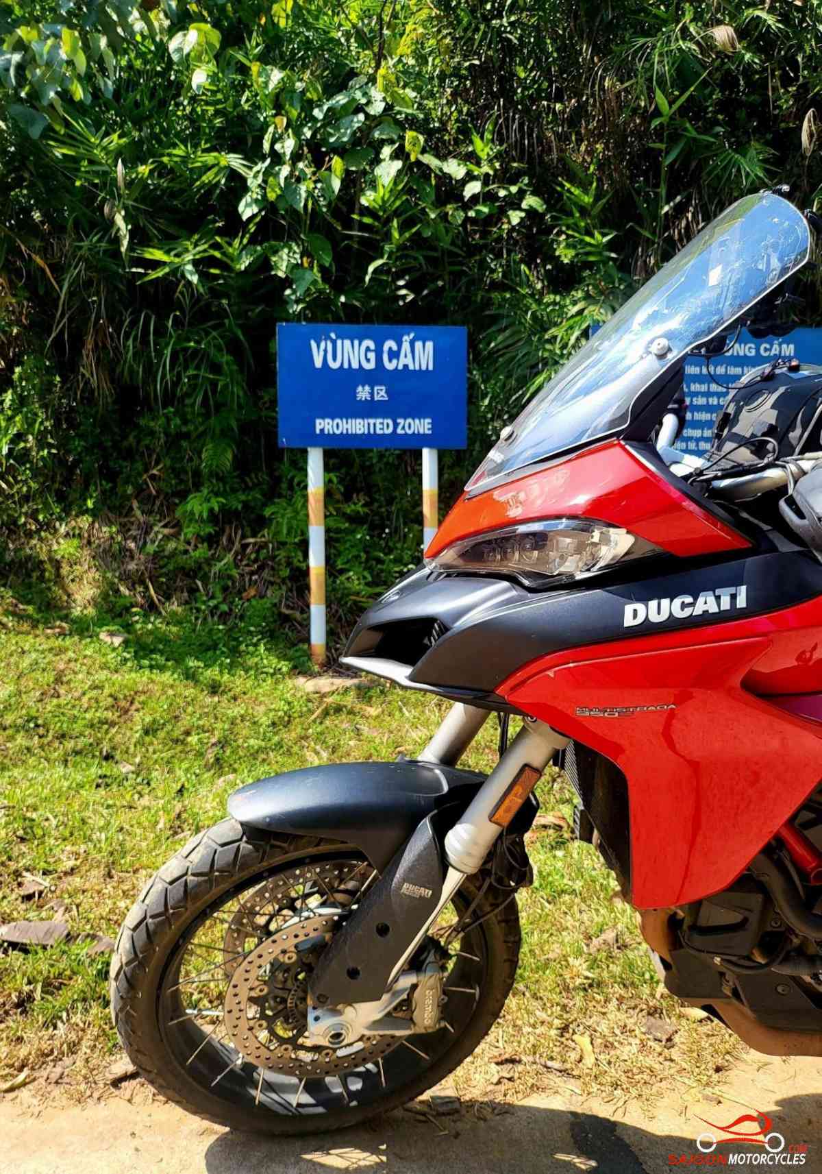
This is the day we have the most interaction with authorities for the entire trip. We are right on the border fence through the morning and a very interesting ride. Stay compliant and polite and you get away with being nosey 😄

(B) The war museum and (C) a trade border crossing. This was closed over Covid obviously but as recent as September 2023 still not reopened.

(D) Quite evident by the access roads to the border fence it’s the Vietnamese who constructed it and many years before any Covid threat.

The minority villagers along the way are not the prettiest example of Vietnamese woman but friendly and hospitable all the same.


(E) is a fuel station. One of very few before you hit the coast.

(F) if you’re running okay time wise this is a good rest and swim stop before you hit the coast. Don’t get excited about revisiting the coastline for a swim. Whilst the far North wins in the mountain wonder, the South definitely has the beaches.


Once we loop back to the main road it’s the least beautiful coastline in the country towards Ha Long. Coal fired power stations and the trucks litter the road with waste that becomes a filthy slurry. Wash the bikes on the way into Ha Long. I imagine it’s very acidic.

(G) Is a swim beach and very few in the region so worth dropping in.

The bay, though also polluted, has the same beautiful monoliths as Tam Coc and Phong Nha but is surrounded by ocean. One of the better known and visited coastal tourist attractions in the country which I find a little ironic.

Spoilt for choice with accommodation here so worth a hotel’s search for a bargain. I’ve stayed at many over the years but only (G) On the map grabbed me. Not cheap but exceptional if you’d like to spoil yourself.
If you have a free day, book an overnight boat experience around the islands. It’s not overly expensive and a few good options in the notes if it appeals. Did this the first time in 2012. Old wooden and quite rudimentary vessels back then. The most recent experience was considerably different.


Ha Long - Hanoi
Distance: 140 kms
There’s no interesting way of doing this. All options are busy so you might as well stick to the wide road and just get it done. If you think HCM drivers and riders are reckless wait until you see the antics of some of these characters. They will look at you and still pull out. It’s like they’re stamping their authority.

If you stay in the Old Quarter on a weekend the Hoan Kiem Lake is shut off to traffic and a pretty cool scene. Buskers and some street performers getting up to some interesting antics. Kids kicking the shuttlecocks in some form of foot badminton.

Plenty of bar and restaurant options in this area also. If sending the bike back on the train this area is much closer to the train station.

The Tay Ho, West Lakes area is the other to consider for your accommodation. Most expats live in this area and also it has plenty of great restaurant and bar options also.

Almost always monkey’s crossing the road or sitting around relaxing, especially during cooler hours of the day.


Good place to wake up to. The morning walk around this lake is exceptional as far as major cities go.


Log in below to view full route maps, accommodation and food information.
These are supplied to all our touring bike customers.
(Excluded from the above itinerary)
Log in below to view full route maps, accommodation and food information.
These are supplied to all our touring bike customers and excluded from the above itinerary.